
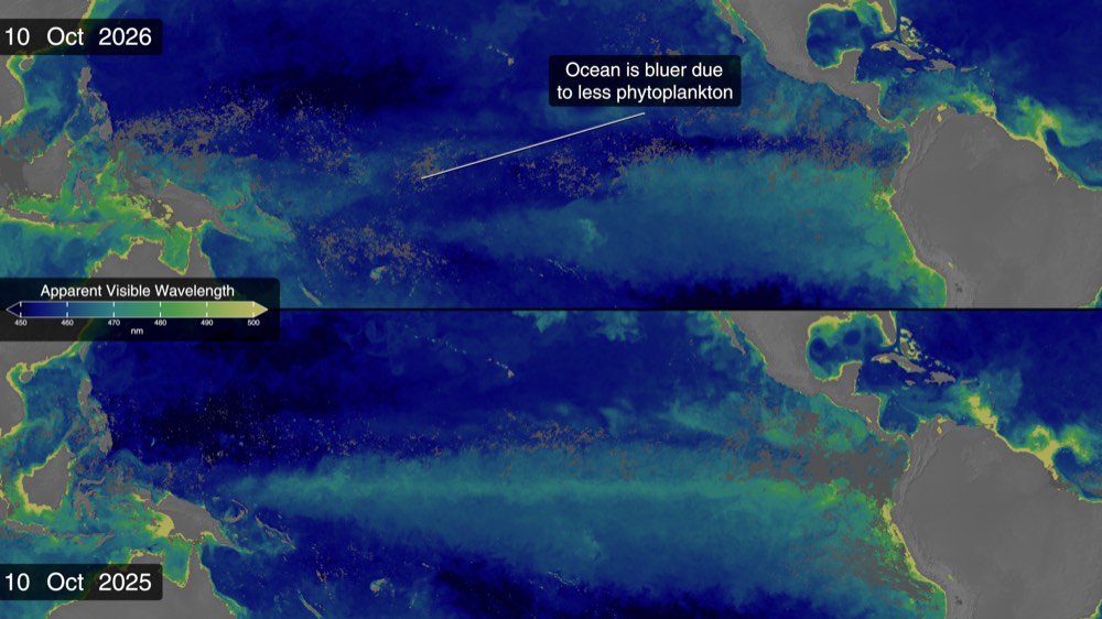
NASA's Oct. 15 satellite analysis shows a broad band of warmer-than-normal water stretching across the equatorial Pacific toward South America's coast. Eastern Pacific sea-surface temperatures were about 1.7°C above the long-term average, NASA reported, while NOAA's Oct. 8 outlook put the chance of an event stronger than any since 1950 at 83% for October–December. That is a probability, not a confirmation that a record has been set. El Niño can shift rainfall patterns and ocean conditions across the Americas, but its effects vary by location and season. NASA is combining sea-level, temperature and ocean-color observations to monitor the developing pattern. The satellite maps can show physical signals; they do not replace local forecasts for communities preparing for heat, drought or heavy rain.
NASA satellites track an El Niño that could rank among the strongest on record
The agency's ocean maps show an expanding warm band in the eastern Pacific, but the record-level outcome remains uncertain.
Source published 2026-10-15 · Updated October 22, 2026